Here I present some exemplary maps — old and new, real and fictional. The newest ones are at the top.
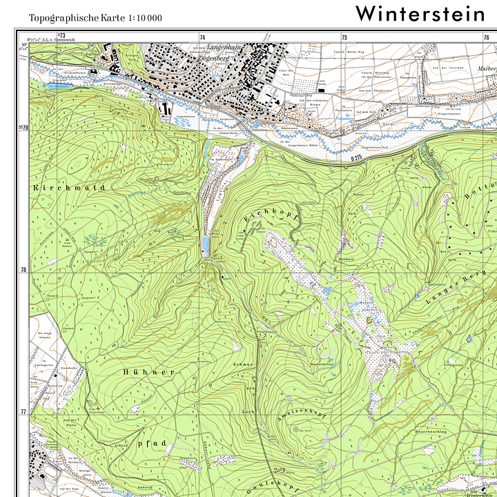
Scale 1 : 10,000, map image 55 · 55.7 cm², 2016 to present. — A topographic map of my homeland, which I have drawn over years of work and occasionally update. The map image follows the classic style of Hessian state surveying in the late 20th century, which is, in my opinion, unsurpassed in terms of aesthetics and accuracy; I regret that the state surveying agency has abandoned it. Unlike the official topographic maps, however, this one has a scale of 1 : 10,000 instead of 1 : 25,000 — making it by far the most accurate map of the depicted area currently available, and it will certainly remain so in the medium term. Source materials included, among others, OpenStreetMap, Google aerial images, geodata published by the state of Hesse, as well as many other recent and historical maps. I had to manually survey the rocks and many ponds with GPS. This map is available in several variants: colour (standard), colour with shading, and black and white. Here is the standard colour version:
Color with shading:
Black and white:

Scale 1 : 18,000,000, 11.7 · 11.3 cm², 2022. — A map of the situation of the West Germanic languages around 580 AD. It serves to illustrate Wolfram Euler, The West Germanic, Verlag Inspiration Unlimited, 2nd ed. Berlin 2022, as well as the Wikipedia article “West Germanic languages”

Scale 1 : 18,000,000, 11.7 · 10.8 cm², 2022. — The situation of the West Germanic idioms around 476 AD in motion. The map serves to illustrate ... and the Wikipedia article “History of Englisch”.

Scale 1 : 5,000, 3,500 · 2,500 square pixels, 2014. — A plan of my fictional city St. Michel am Felsen (“St Michael at the Rock”), the subject of my watercolour painting “Turmbläser” as well as the topographic map below. Stylistically, it follows a very common type of German city map. Here you can find the plan as a PDF file.

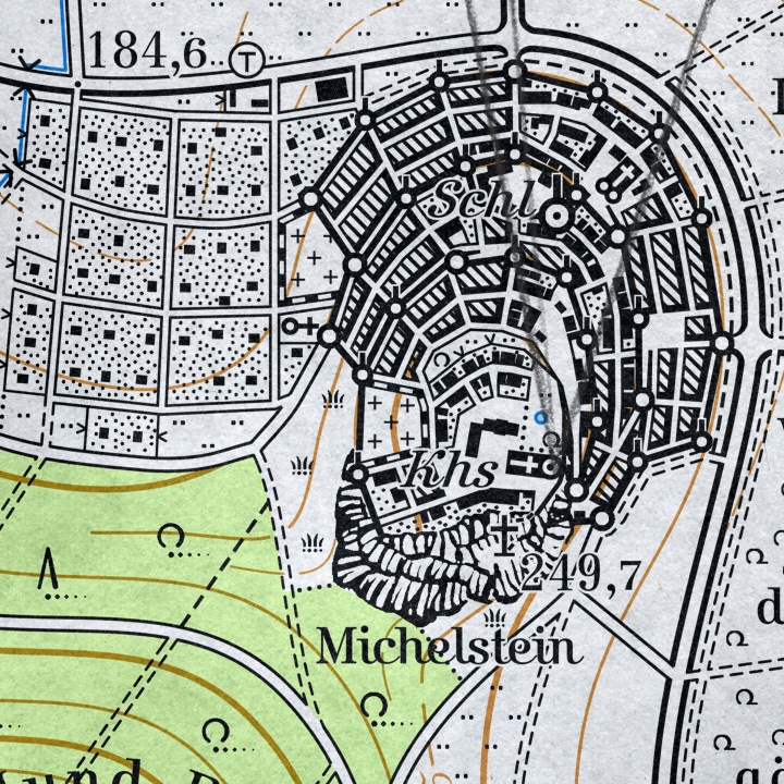
Scale 1 : 25,000, 2,150 · 4,250 square pixels, 2013. — Artistic representation of a topographic map in the style of German state surveying in the late 20th century. It shows my fictional city St. Michel am Felsen and its surroundings, the setting of my watercolour painting “Turmbläser”. The visible image section in the painting is marked in pencil.
Detail view with the city of St. Michel:


Scale 1 : 2,000,000, 135 · 180 cm², 2006. — An overview map of the Western Front in the First World War, which I designed at the time for the player community of the online flight simulator “Richthofen’s Skies” and provided in four versions (English and German, colour as well as black and white).
