Here you find a selection of historical maps displaying the political situation of Europe during antiquity and late antiquity. As the authors of these old prints are already dead since more than seventy years, their work is in public domain now and thus can freely be used. At this point I’ve to thank Nick Wedd who has made the effort of scanning the maps.
The print versions are variants of the maps which I have magnified from 300 to 600 dpi (i. e. interpolated) and converted to black and white (1 bit). In order to print these maps just save the .png-files, open them using a graphics programme (such as Gimp) and print them in original size.
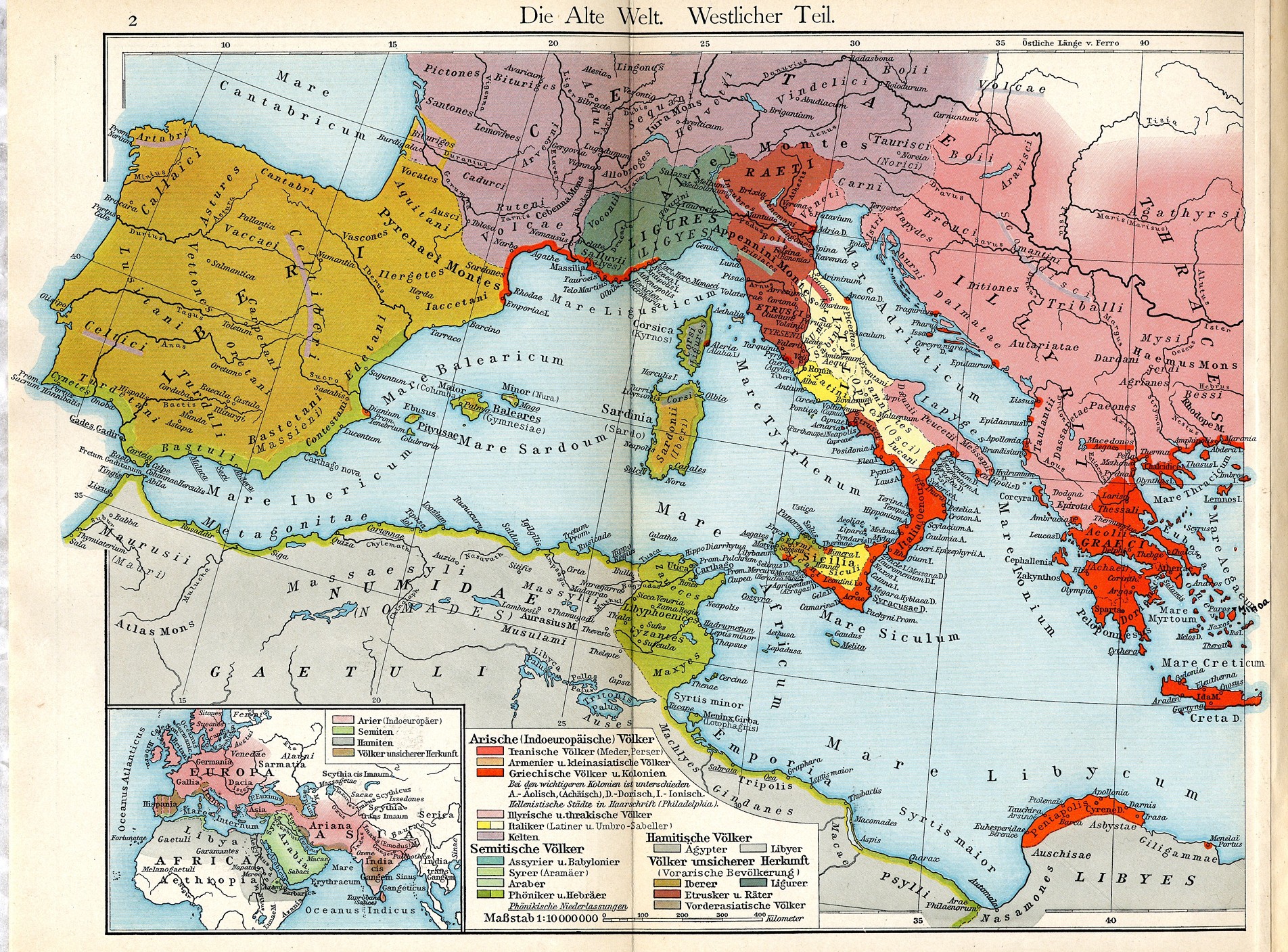
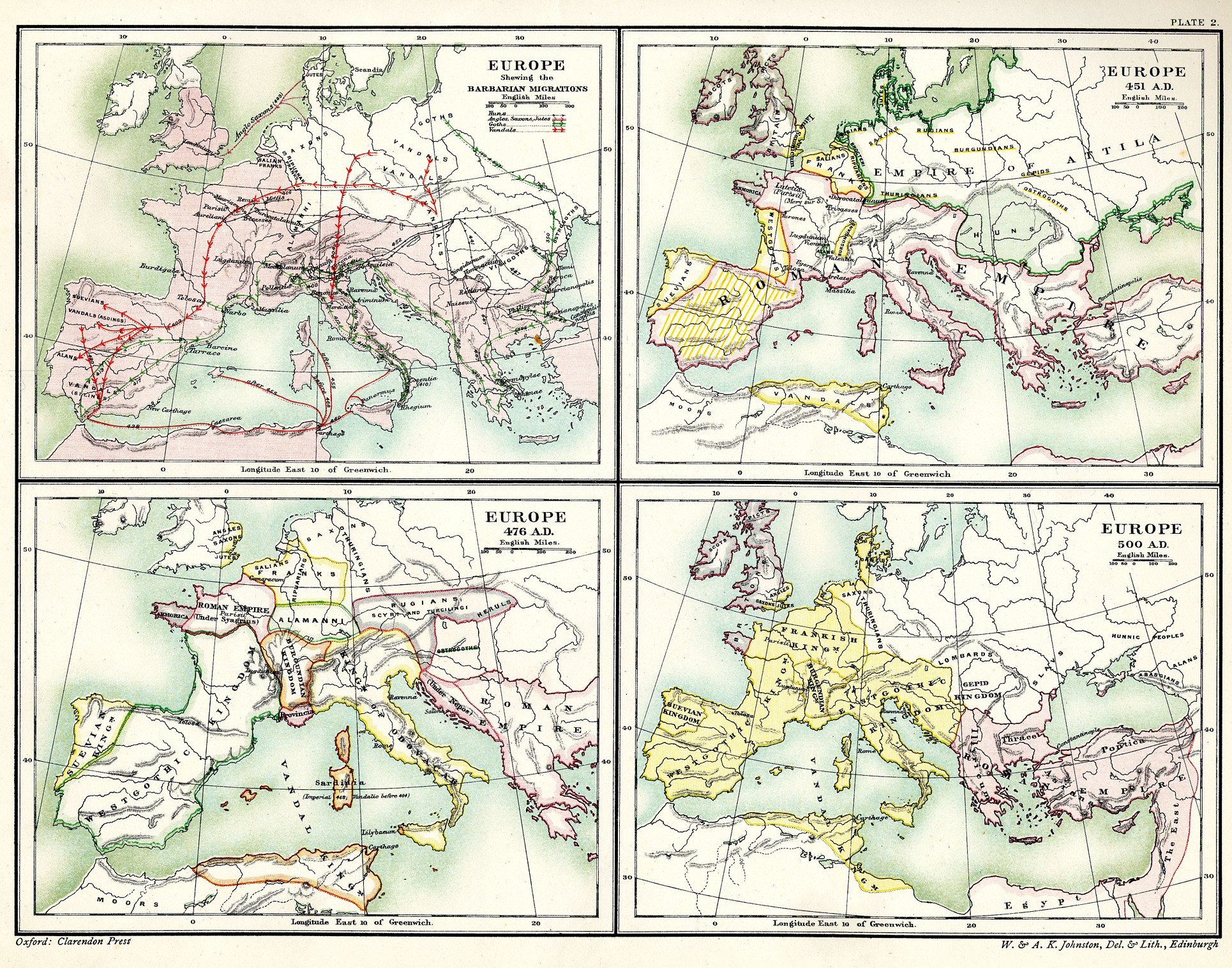
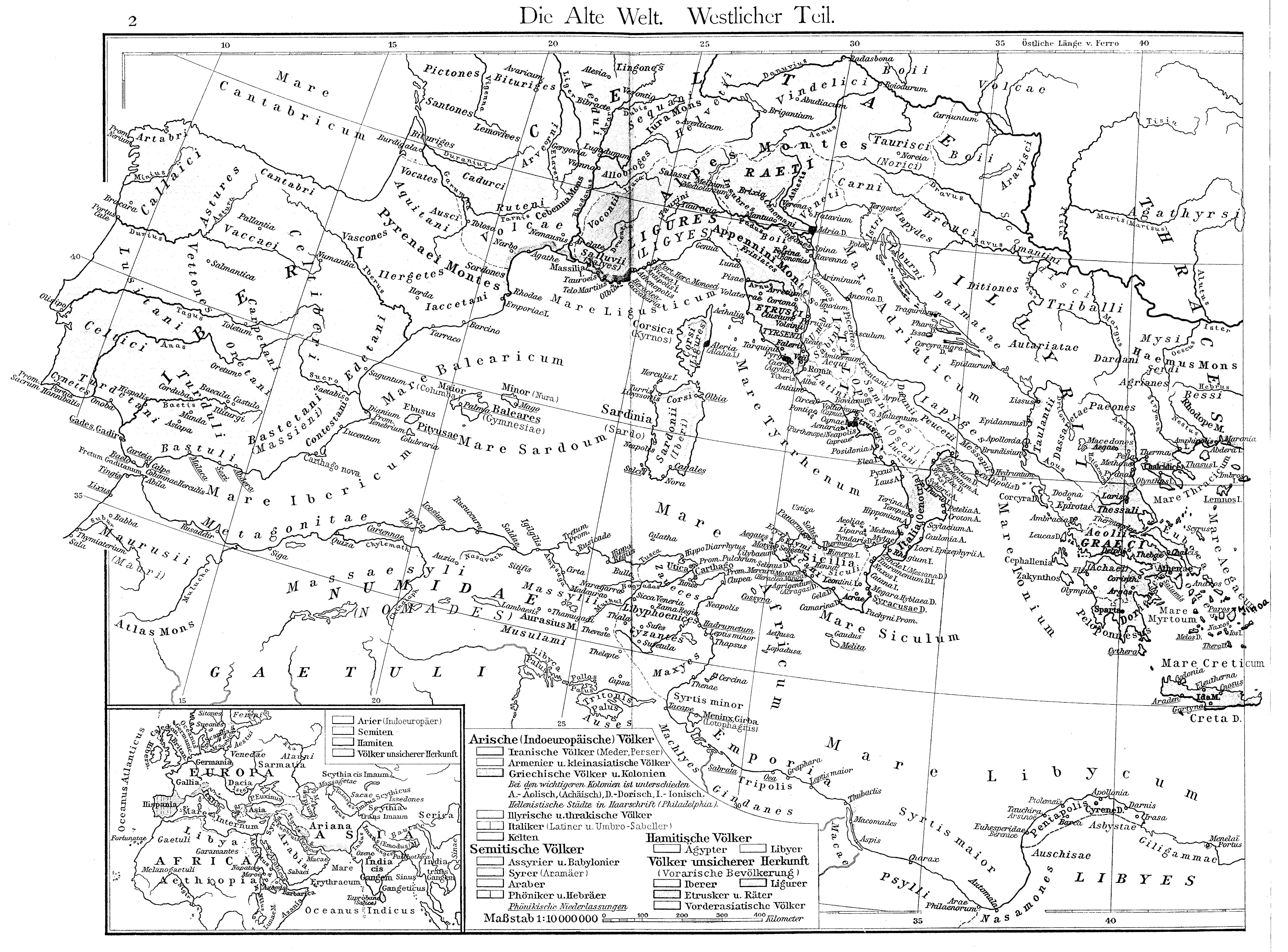
Friedrich Wilhelm Putzgers Historischer Schul-Atlas, 29th Edition, Bielefeld and Leipzig 1905, Plate 2.
|
|
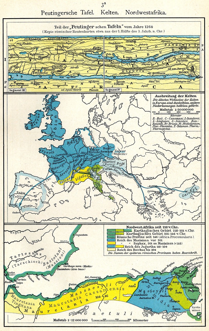
Friedrich Wilhelm Putzgers Historischer Schul-Atlas, 29th Edition, Bielefeld and Leipzig 1905, Plate 3 a.
 |
|
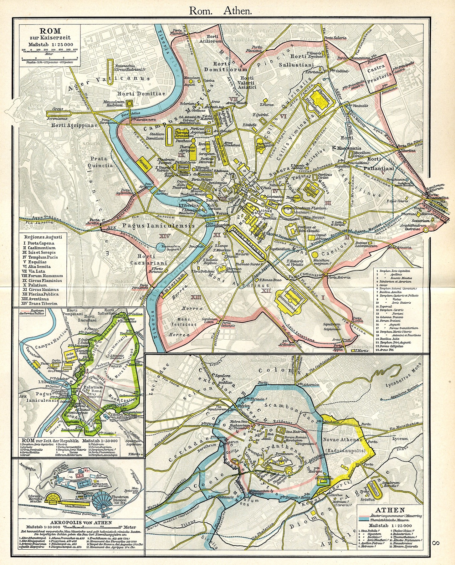
Friedrich Wilhelm Putzgers Historischer Schul-Atlas, 29th Edition, Bielefeld and Leipzig 1905, Plate 5.
 |
|
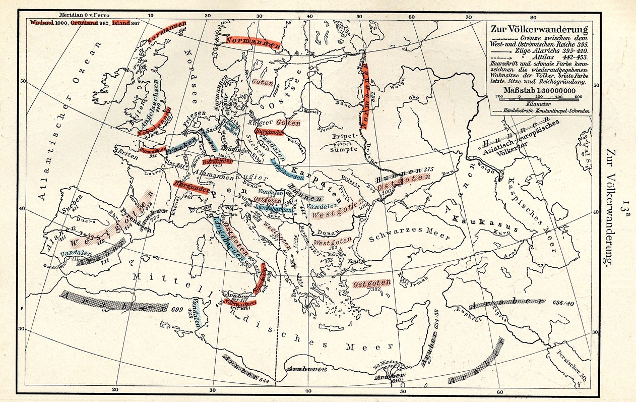
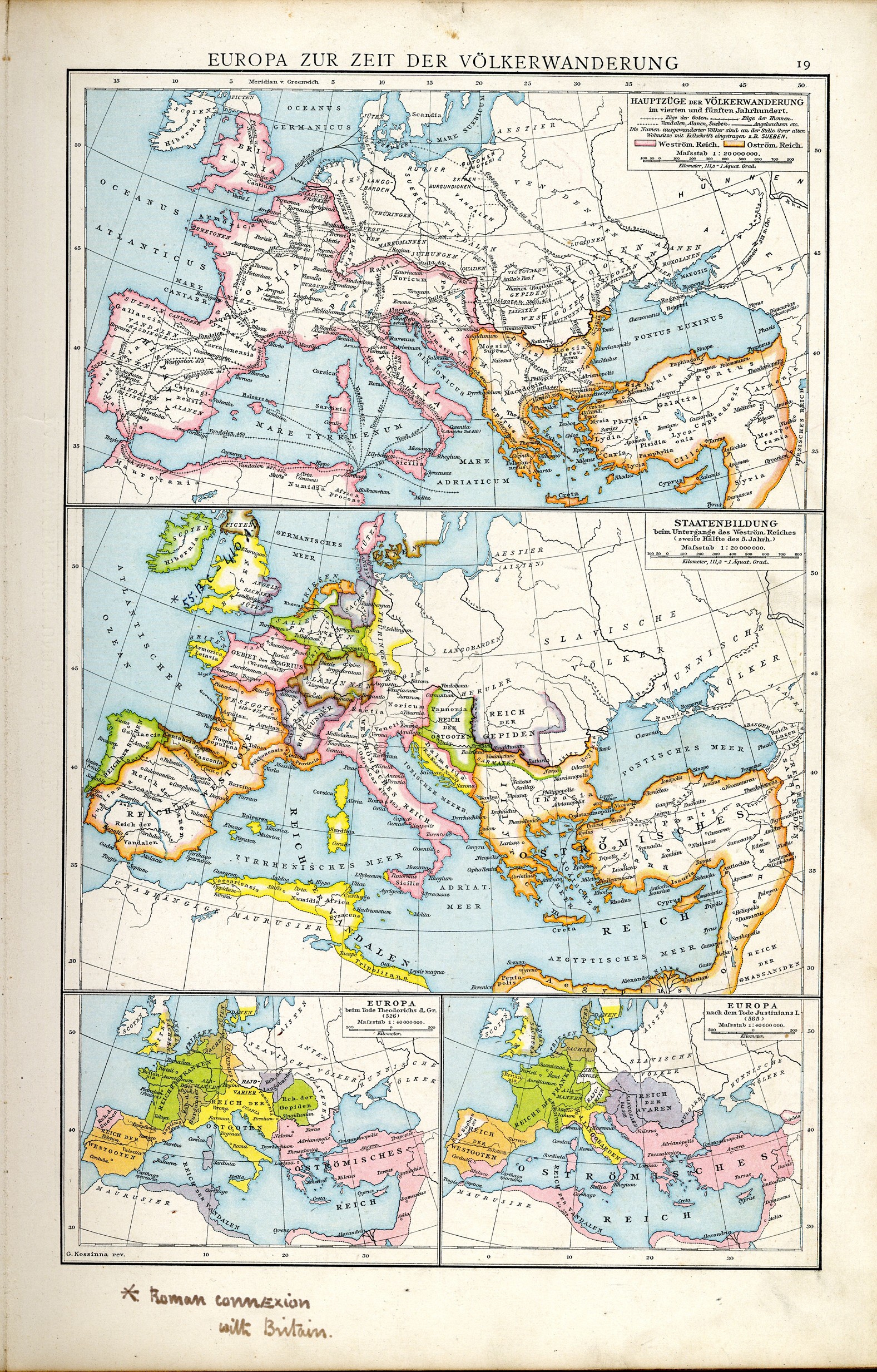
Friedrich Wilhelm Putzgers Historischer Schul-Atlas, 29th Edition, Bielefeld and Leipzig 1905, Plate 9.
 |
|
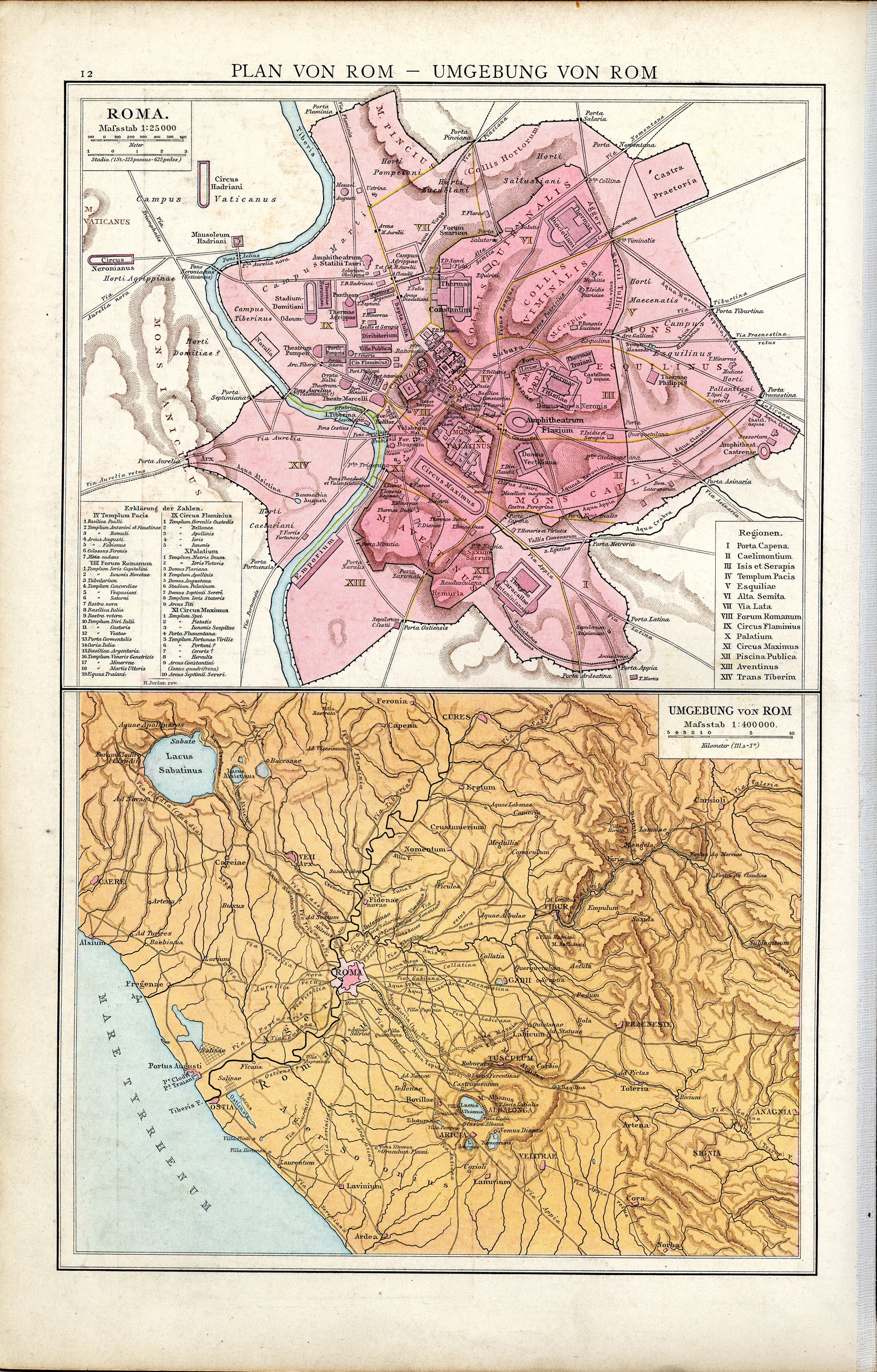
Friedrich Wilhelm Putzgers Historischer Schul-Atlas, 29th Edition, Bielefeld and Leipzig 1905, Plate 12.
 |
|
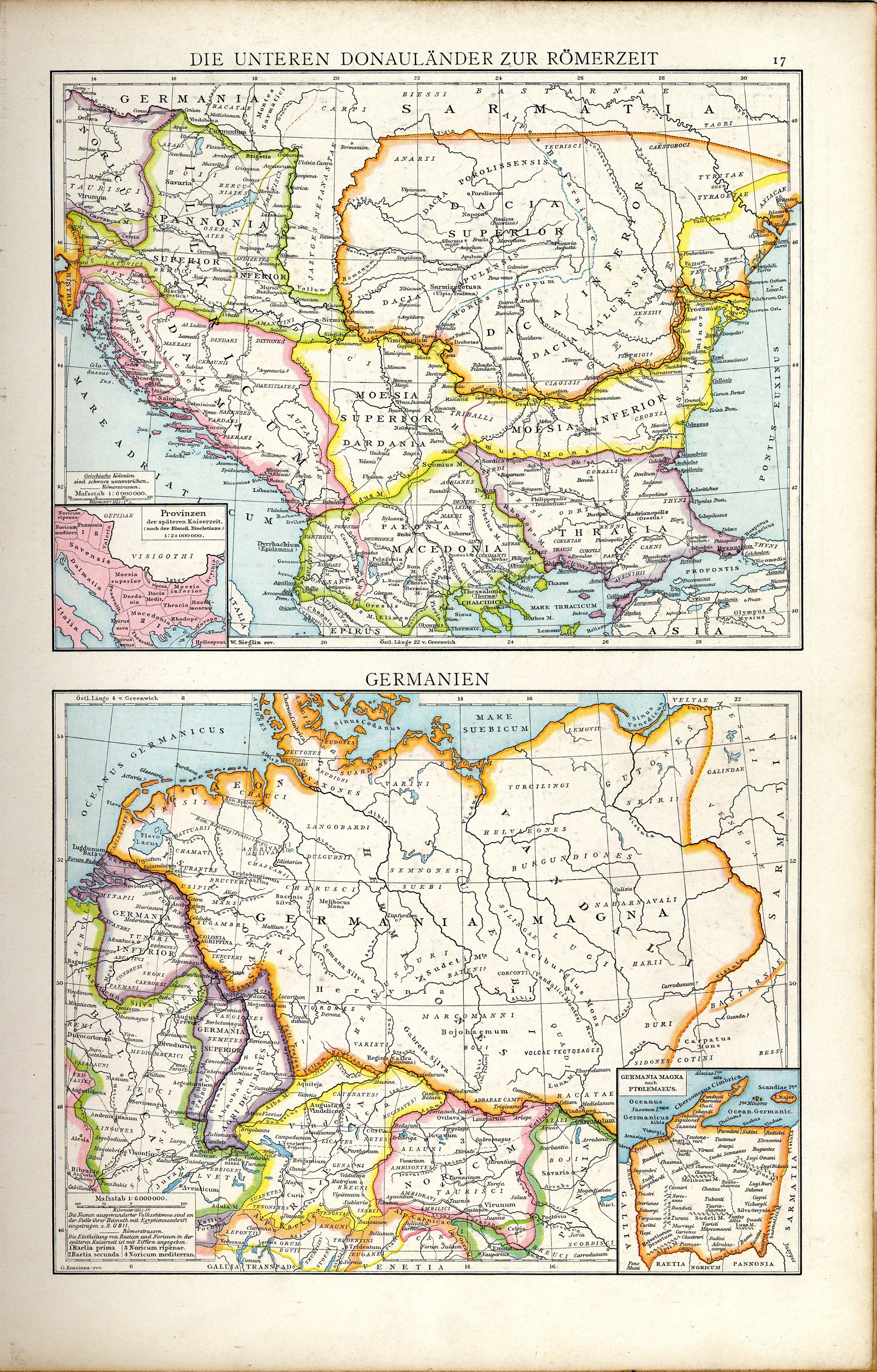
Friedrich Wilhelm Putzgers Historischer Schul-Atlas, 29th Edition, Bielefeld and Leipzig 1905, Plate 13 a.
 |
|
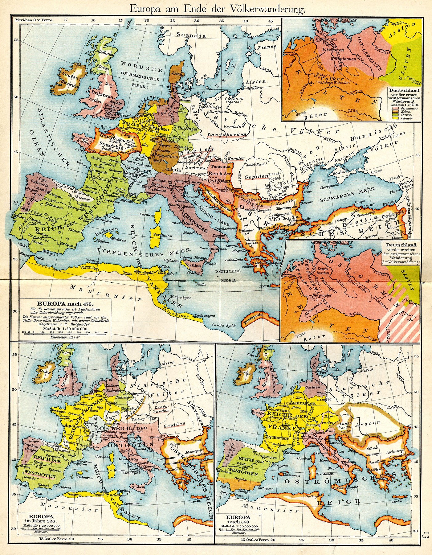
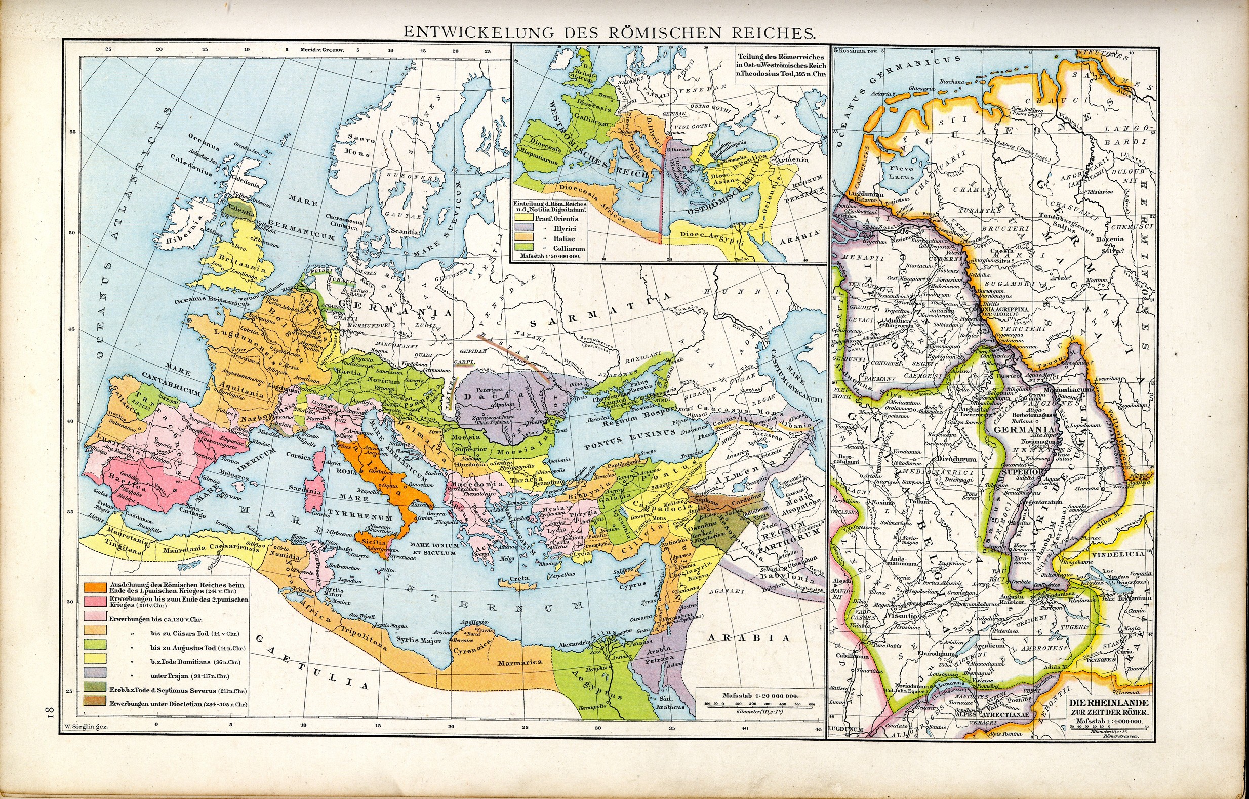
Friedrich Wilhelm Putzgers Historischer Schul-Atlas, 29th Edition, Bielefeld and Leipzig 1905, Plate 13.
 |
|
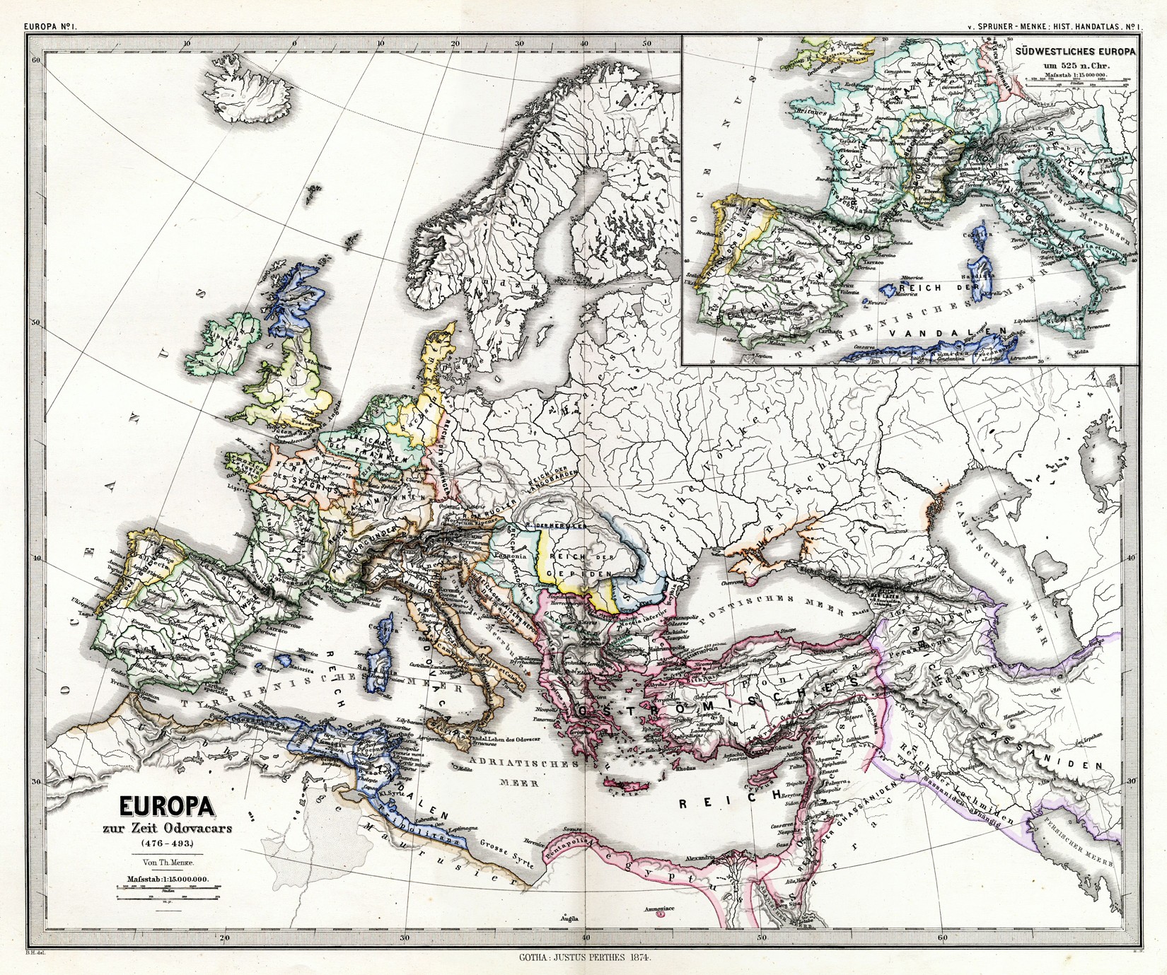
Karl von Spruner (Begr.) / Theodor Menke, Hand-Atlas für die Geschichte des Mittelalters und der neueren Zeit, 3rd Edition, Gotha 1880, Plate 1.
 |
|
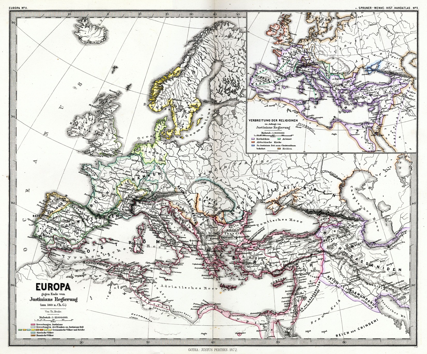
Karl von Spruner (Begr.) / Theodor Menke, Hand-Atlas für die Geschichte des Mittelalters und der neueren Zeit, 3rd Edition, Gotha 1880, Plate 2.
 |
|
Karl von Spruner (Begr.) / Theodor Menke, Hand-Atlas für die Geschichte des Mittelalters und der neueren Zeit, 3rd Edition, Gotha 1880, Plate Europa 21.
 |
|
Reginald Lane Poole, Historical Atlas of Modern Europe, Oxford 1902, Plate 2.
 |
|
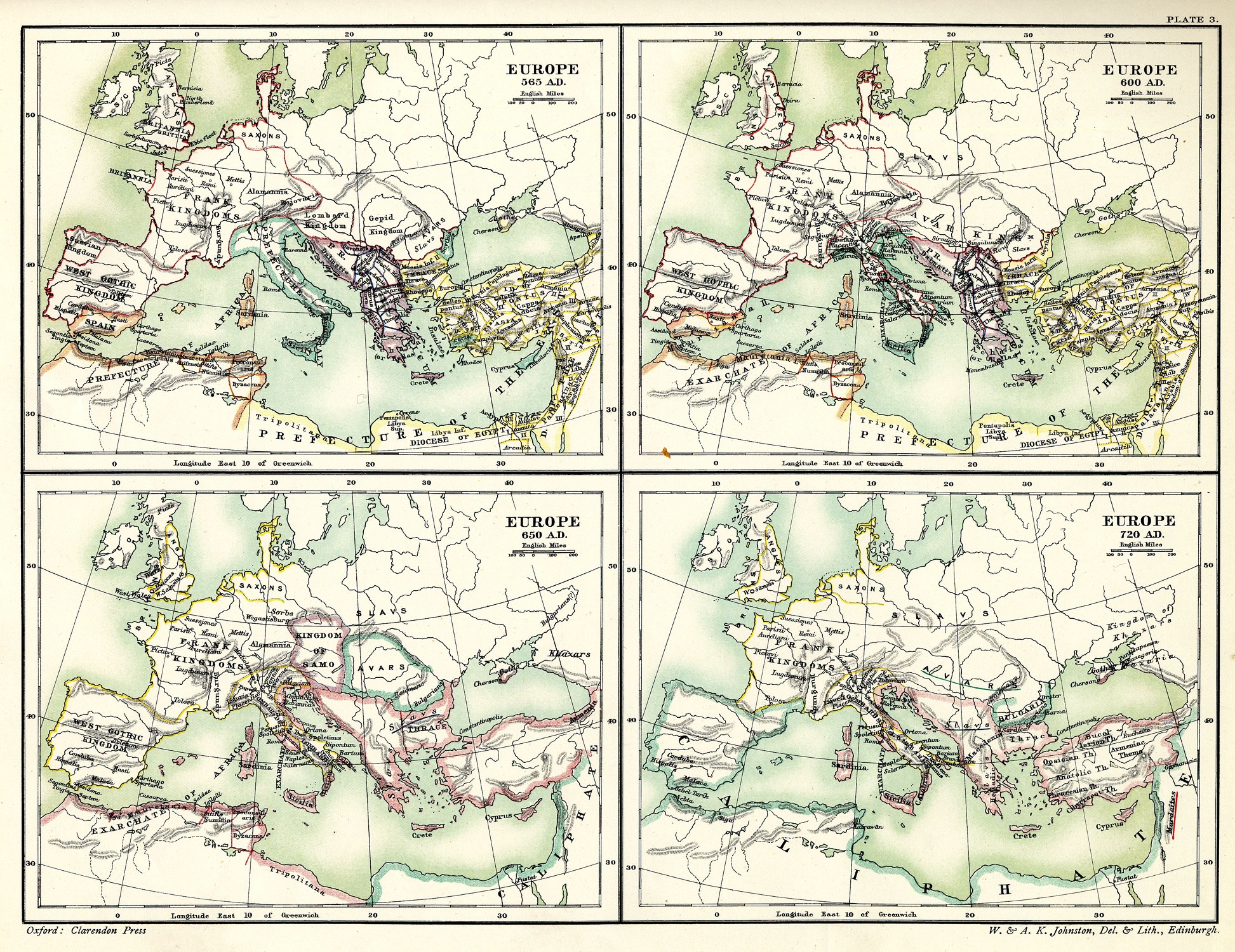
Reginald Lane Poole, Historical Atlas of Modern Europe, Oxford 1902, Plate 3.
 |
|
Gustav Droysen / Richard Andree (Hrsg.), Professor G. Droysens Allgemeiner Historischer Handatlas, Bielefeld and Leipzig 1886, Plate 12.
 |
|
Gustav Droysen / Richard Andree (Hrsg.), Professor G. Droysens Allgemeiner Historischer Handatlas, Bielefeld and Leipzig 1886, Plate 17.
 |
|
Gustav Droysen / Richard Andree (Hrsg.), Professor G. Droysens Allgemeiner Historischer Handatlas, Bielefeld and Leipzig 1886, Plate 18.
 |
|
Gustav Droysen / Richard Andree (Hrsg.), Professor G. Droysens Allgemeiner Historischer Handatlas, Bielefeld and Leipzig 1886, Plate 19.
 |
|

 Print version
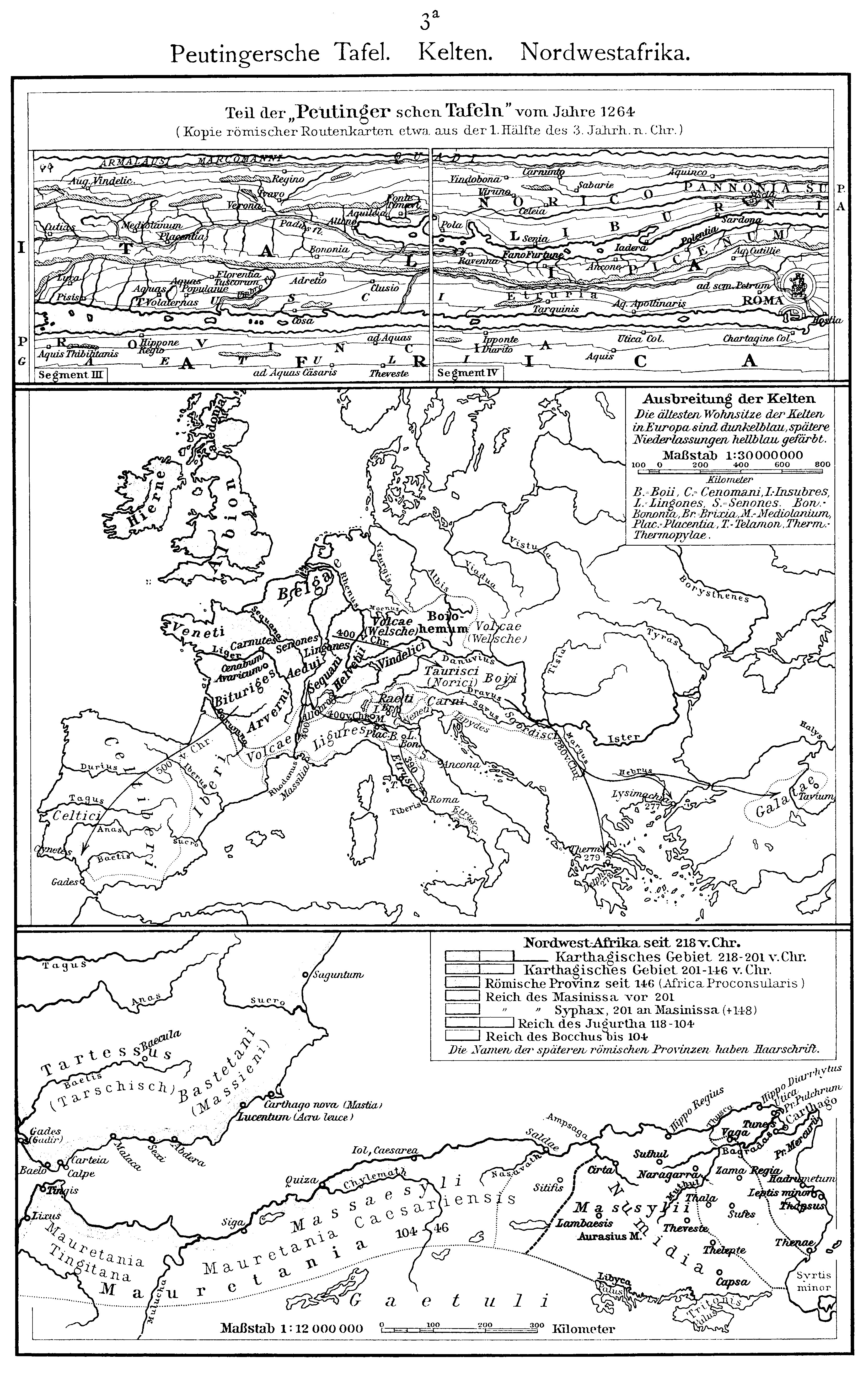 Print version
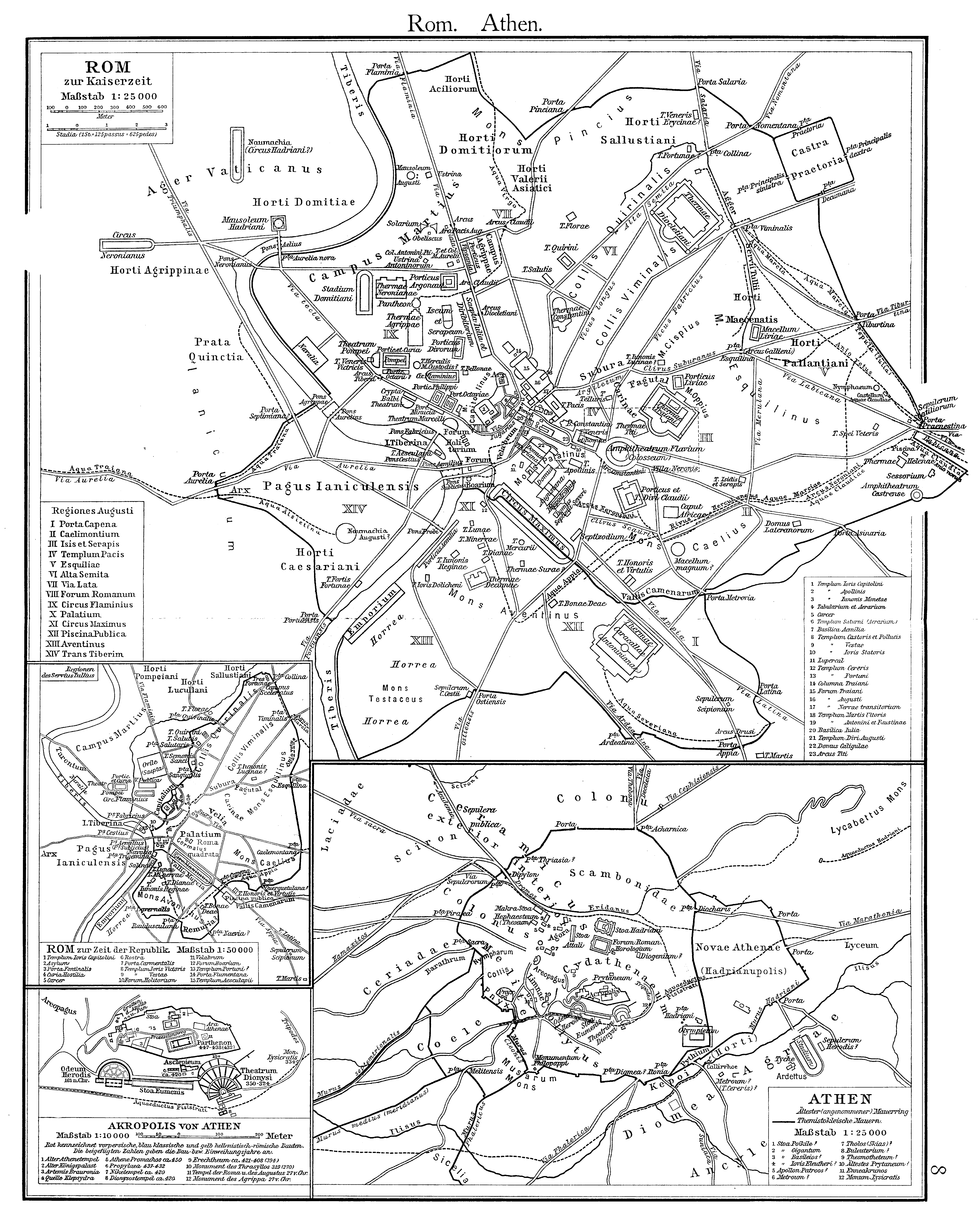 Print version
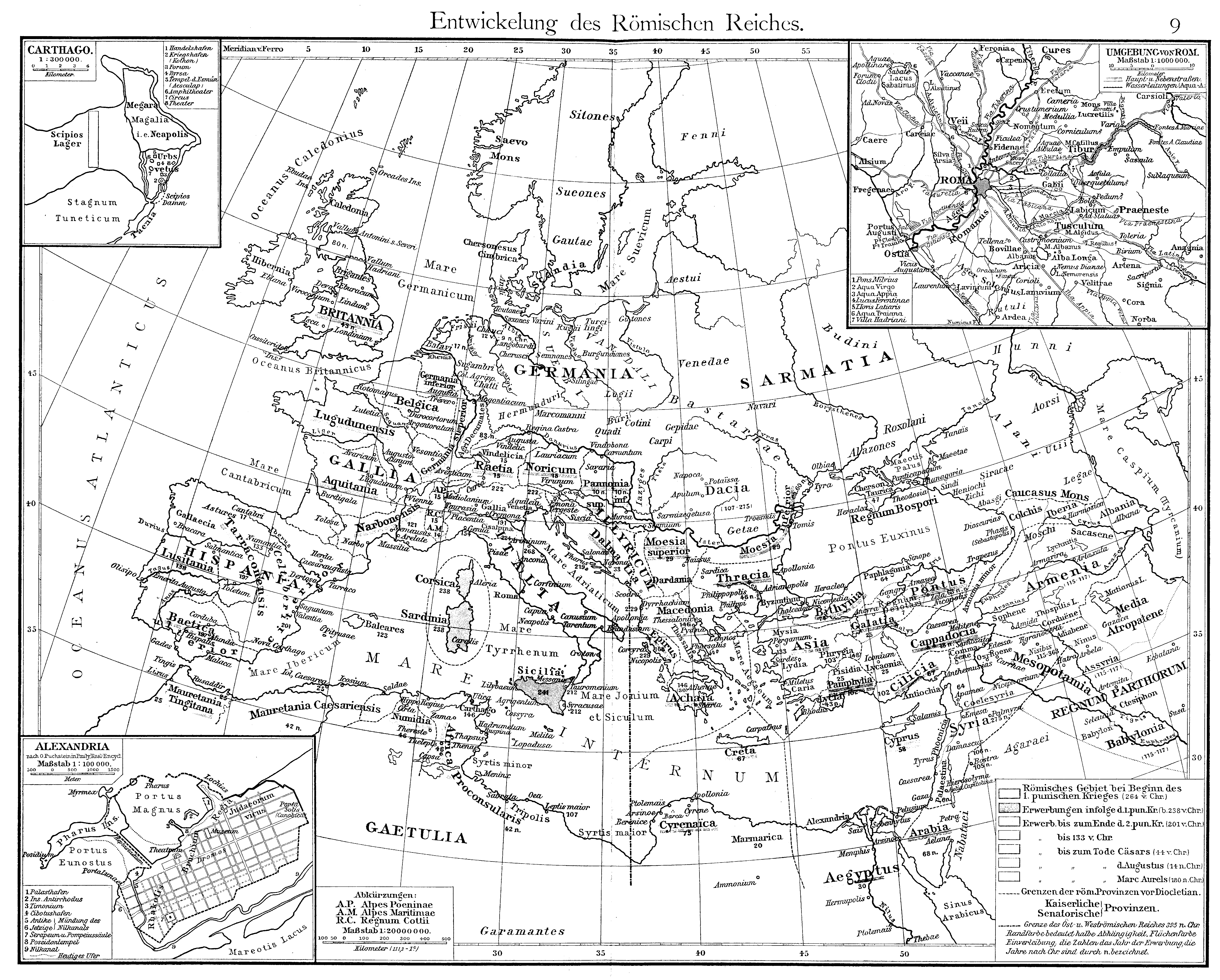 Print version
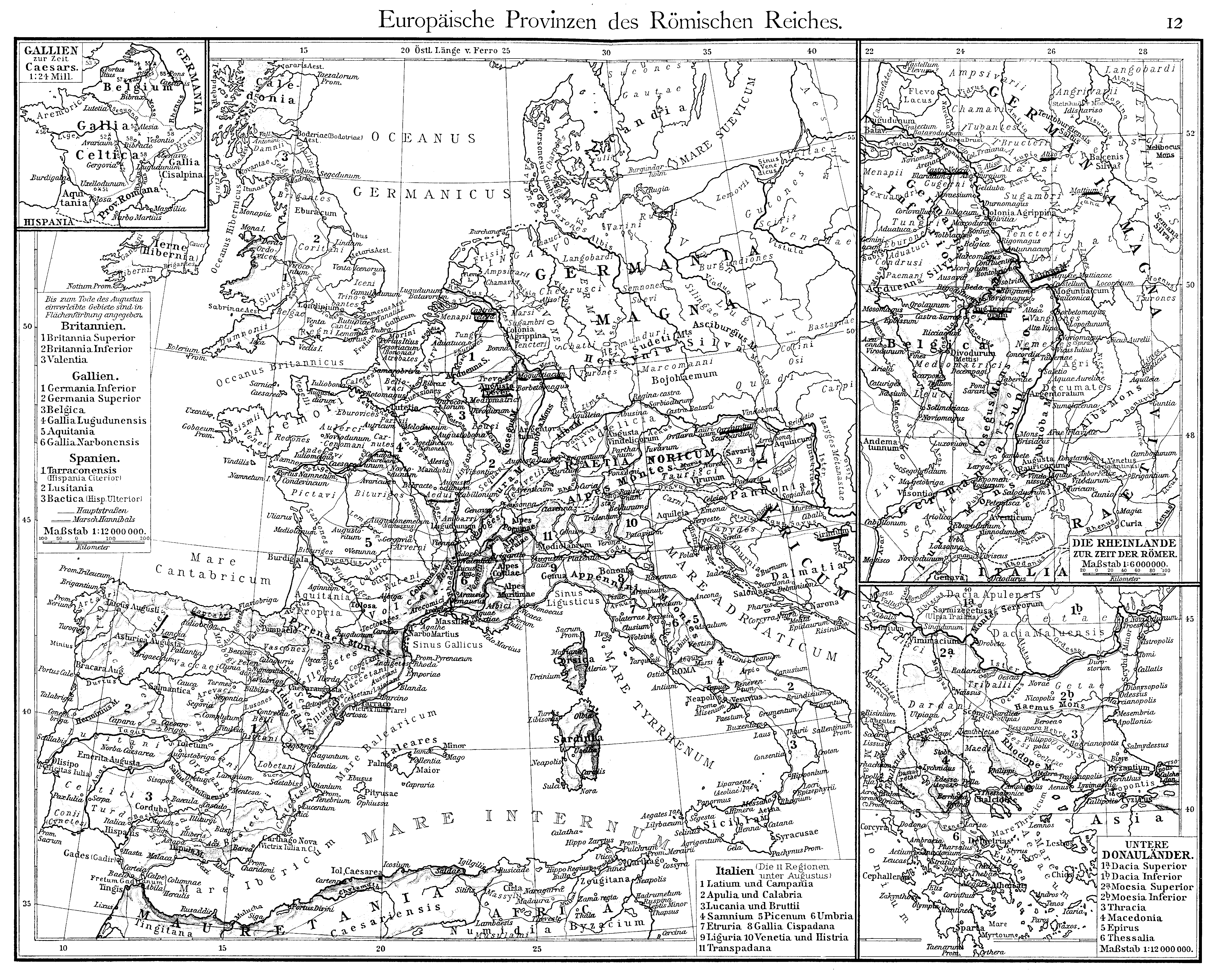 Print version
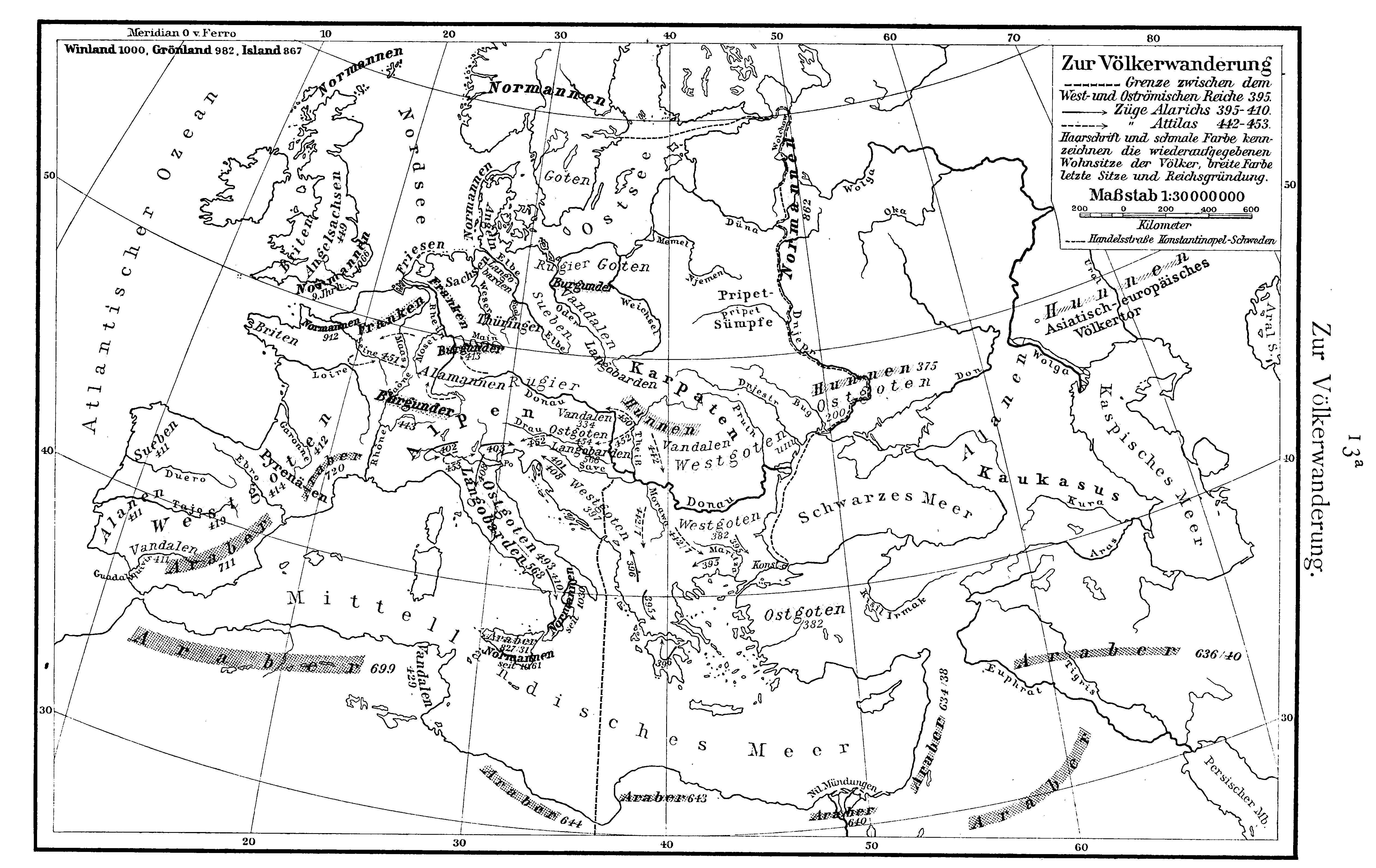 Print version
 Print version
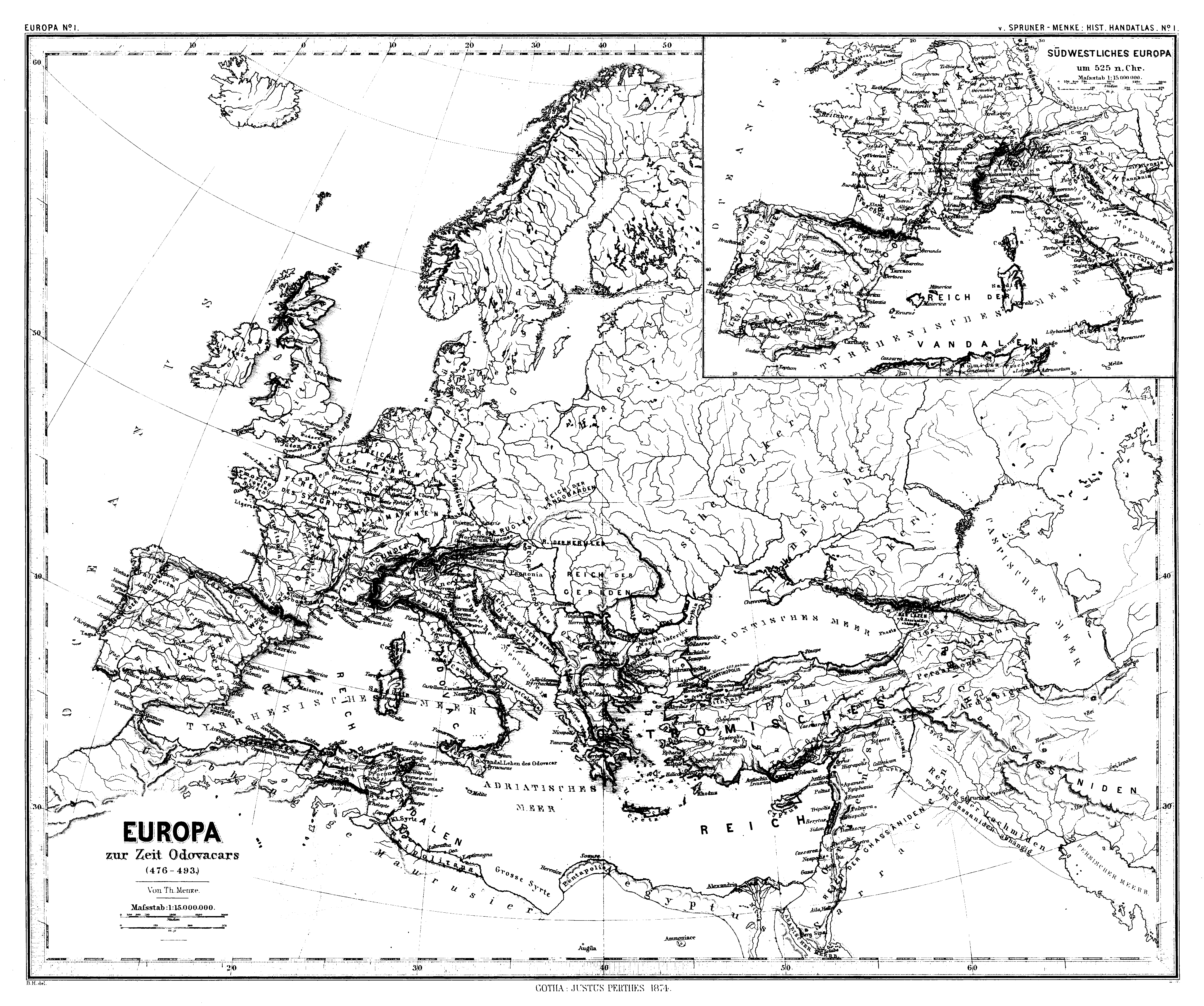 Print version
 Print version
 Print version
 Print version
 Print version
 Print version
 Print version
 Zoom
Zoom Print version
 Print version